

You likely know Utah’s big-name national parks, Arches, Zion, Bryce Canyon, Canyonlands, and Capitol Reef, known as the Mighty 5. But 80 percent of the state is dedicated for public use, and plenty of lesser-known monuments offer mazes of slot canyons, deposits of dinosaur fossils, and lands free of modern-day footprints.
With so many great natural areas to choose from, below are eight of Utah’s best national parks and monuments to visit.

Delicate Arch, located in Arches National Park, is depicted on some Utah license plates.
Photo by John A Davis
1. Arches National Park
- Why go: Landscapes that become even more beautiful and lively when the sun goes down
- Nearest town: Moab, Utah
- Where to stay: Try one of 50 suite-style tents with the May 2023-opened Ulum, a high-end glamping brand from Under Canvas.
More than 2,000 natural arches dot east-central Utah, an impressive number unequalled anywhere in the world. But if you’ve been to Arches National Park years ago, you haven’t seen it as it is today; the forces that shaped the landscape continue carving, elongating, and widening each formation until its inevitable collapse.
Most visitors’ first stop is Delicate Arch, the largest freestanding arch in the park. There’s a lack of shade and challenging slickrock terrain along the three-mile, round-trip hike to the solitary arch; still, expect crowds in summer—especially at sunset.
Other notable (and more accessible) landmarks include Landscape Arch, the North and South Windows, and Balanced Rock, all of which can be reached via two-mile or shorter hikes. They’re by no means unworthy of their delicate cousin—the 306-foot-long Landscape is one of the longest arches in the world.
Tip: Arches appears lifeless, but most animals here—which include mule deer and porcupines—are nocturnal. Stay to stargaze from the Garden of Eden viewpoint or Balanced Rock picnic area, and the cosmos won’t be the only stars of the show.
2. Zion National Park
- Why go: Intense hiking opportunities and gorgeous views for every season
- Nearest town: Springdale, Utah
- Where to stay: In May 2023, glamping company AutoCamp opened a 16-acre hub (which includes a communal Clubhouse) merely 14 miles from Zion’s main entrance.
More than 4 million people visit Zion National Park annually, making it among the most visited national parks. Here in Utah’s southwest corner, the Virgin River carved through 2,000 feet of porous sandstone, forming a canyon so grand it needed a name equally majestic: In Hebrew, “Zion” means “promised land.”
The 2.7-mile vertiginous hike to Angels Landing isn’t for everyone, but if you make it to the top, the awe-inspiring view makes it clear why paradisiacal names pervade in this rugged wilderness of vertical walls painted in oranges, reds, and greens. Less dramatic hikes to the Narrows via Riverside Walk or the Upper and Lower Emerald Pools are similarly memorable.
The seasons drastically change Zion’s landscape; cottonwood trees glow gold in the fall, the ridges shine with snow in winter, and ephemeral waterfalls and pools spring to life in summer. There’s no bad time to visit Zion.
Tip: Private vehicles are prohibited along Zion Canyon Scenic Drive during high season. Bicycle the 17.2-mile main drag as an alternative to using the shuttles. Permits aren’t required; just be sure to yield to buses.

The sculpted formations of Bryce Canyon were created by wind, rain, and water over millions of years.
Photo by evenfh/Shutterstock
3. Bryce Canyon National Park
- Why go: Showstopping overlooks and rock spires
- Nearest town: Bryce Canyon City, Utah
- Where to stay: Under Canvas Bryce Canyon offers 50 Deluxe and Suite tents—complete with wood floors and West Elm furniture—just 15 minutes from the park’s entrance.
At Bryce Canyon’s edge, the world drops off into a scene of geological carnage—the past 60 million years have done a number on this section of southern Utah, turning it into the world’s largest collection of hoodoos.
The park’s 18-mile scenic drive takes you by a slew of amphitheaters. But at 12 miles long, 3 miles wide, and 800 feet deep, Bryce Amphitheater steals the show. (The famous, bowl-shaped, sloping formation is actually an amphitheater.) You’ll find the best views at the first four main overlooks.
Hike down into the rocky landscape via the 2.9-mile Queen’s Garden/Navajo Loop Trail, or pair it with the Peekaboo Loop to complete the comprehensive, 6.8-mile “Figure 8 Combination” across the theater’s floor.
Tip: From Yovimpa Viewpoint, you can see all the way to the Kaibab Plateau—the rim of the Grand Canyon.

In Canyonlands National Park, Mesa Arch is a popular spot for sunrise photographers.
Photo by Lucky-photographer/Shutterstock
4. Canyonlands National Park
- Why go: Underrated introduction to the red rock scenery of the Southwest
- Nearest town: Moab, Utah
- Where to stay: For an alternative to the luxury safari-esque accommodations provided by Ulum, visitors can opt to camp in Canyonlands on their own.
Southwest of Moab, Canyonlands National Park features the best aspects of your favorite Southwestern parks: canyons carved by the Colorado, massive red-rock arches, fields of hoodoos. Consider this “Utah Landscape 101.”
Chalk up the sparse crowds to a lack of accessibility, not a lack of grandeur: Canyonlands has four separate districts, and you can’t access one from another. Island in the Sky is the most popular and accessible. Here, head to Grand View Point for panoramas of the White Rim sandstone cliffs or hike the mile circumference of the impact crater, Upheaval Dome.
With one paved road, the Needles district is rugged and difficult to navigate, so its many trails are consistently quiet. The Maze district is harder still to access. The Colorado and Green rivers make up the fourth district; parts of both are calm enough for kayaking.
Tip: Mesa Arch is positioned perfectly for sunrise photography. No need to get up at dawn—the sun hangs beneath or behind the arch well into the morning.
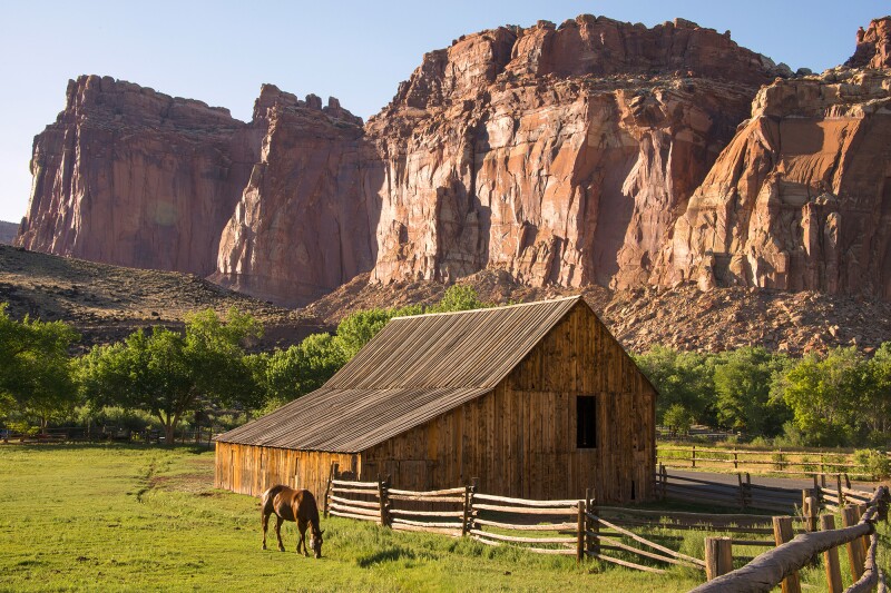
Near the Gifford Homestead, farmland among the rocks of Capitol Reef
Photo by JKO Photos/Shutterstock
5. Capitol Reef National Park
- Why go: Scenic drives and incredible viewpoints in an underrated park
- Nearest town: Torrey, Utah
- Where to stay: While luxury stays are a comfortable option, the park’s Fruita Campground offers the unique experience of staying in a fruit orchard amidst canyon land.
The Waterpocket Fold is the through line of Capitol Reef National Park, a nearly 100-mile wrinkle of central Utah replete with colorful canyons, tortured desert, and numerous bridges and arches. The 25-mile, round-trip Capitol Reef Scenic Drive is a good introduction to this stark, twisted landscape, but you’ll want to get out of the car for the two-mile trek to the natural, 133-foot Hickman Bridge and for the views at Panorama Point.
The unforgiving desert softens into farmland near the visitor center. There, pick fruit in active, open orchards or simply get a pie from Gifford Homestead between hikes. Mormon pioneers farmed these orchards as early as 1880, although the area’s human history dates back 9,000 years. Spot Fremont-culture pictographs and petroglyphs throughout the park, and enjoy up-close views along the one-mile Capitol Gorge Trail.
Tip: Take the Capitol Gorge spur at the end of the scenic drive. From its terminus, hike one mile into a slot canyon where you’ll find the Pioneer Register—names of courageous settlers who traveled here starting in 1871—etched neatly into the rock.

Dinosaur National Monument offers archaeological remains and memorable canyon views.
Photo by Zack Frank/Shutterstock
6. Dinosaur National Monument
- Why go: Ancient remains you can see (and even touch)
- Nearest town: Vernal, Utah
- Where to stay: Camping options are plentiful in the area, whether you decide to stay at a campground or go backcountry camping with a permit.
The 210,000-acre Dinosaur National Monument straddles the Colorado-Utah border, but if you’re here for fossils, stick to Utah. You can see over 1,500 dinosaur fossils in the Quarry Exhibit Hall alone. Located near the Quarry Visitor Center, the hall features a fossil-filled, exposed cliff face encased in glass, as well as 150-million-year-old specimens you can touch.
While it lacks archaeological remains, the Colorado side of the monument boasts spectacular canyon scenery. At the end of Harpers Corner Scenic Drive, a steep, unpaved road winds down to the confluence of the Green and Yampa rivers. Here, sheer cliff faces cage the waters in Echo Park, the most dramatic point of the Yampa River Canyon.
Tip: On the Utah side, take the less-traveled Tour of Tilted Rocks, a 10-mile scenic drive along the Green River. Keep an ear out for yipping coyotes or prairie dogs rustling in the sagebrush.

Adventurous travelers love Grand Staircase–Escalante National Monument for its many arresting slot canyons.
Photo by Galyna Andrushko/Shutterstock
7. Grand Staircase–Escalante National Monument
- Why go: Remote, rich landforms ideal for canyoneering
- Nearest town: Kanab, Utah
- Where to stay: If you’re staying west of Escalante, consider a cabin or Airstream at Yonder Escalante. Head closer to Lake Powell and you can enjoy live acoustic music and complimentary s’mores at the nearby Under Canvas location.
Grand Staircase–Escalante was the final frontier of the Lower 48: South-central Utah’s Escalante River was the last of its kind to be mapped and named; it remains one of the remotest areas in the country. Here, there’s still room for discovery.
The antithesis of a dry, desolate wasteland, the Escalante Canyons area features active waterfalls, riparian corridors, and sculpted slickrock. Calf Creek Falls Recreation Area has two 100-foot-plus falls accessible via a six-mile, out-and-back trek, and the slot canyons of Peek-a-boo and Spooky Gulch are fantastic for canyoneering.
Tip: The 2.8-mile trek to Buckskin Gulch, in the slot-canyon wonderland of Grand Staircase, is a canyoneering experience that rivals Antelope Canyon, with fewer crowds and no guide required.

Cedar Breaks National Monument is eroding at a much faster pace than Bryce Canyon.
Photo by K. Bradley Washburn/Shutterstock
8. Cedar Breaks National Monument
- Why go: Sunsets you can have all to yourself
- Nearest town: Brian Head
- Where to stay: Cedar Breaks Lodge in Brian Head is less than a 10-minute drive from the monument and offers amenities like an indoor pool, sauna, and steam room. It’s an especially great stay for the winter, as it is also only a couple-minute walk away from the Brian Head Ski Resort.
Cedar Breaks National Monument appears to be a smaller-but-deeper Bryce Canyon. But at 10,350 feet above sea level, this three-mile-wide, 2,000-foot-deep amphitheater tells a much different story: Not only are the exposed rocks different and sometimes more colorful, but the factors that sculpt the land are also less kind. Cedar Breaks receives far more snow and rain than Bryce, so the landscape is eroding at a phenomenal rate. The parking barriers, right on the rim, have already been moved once.
Two main trails—Sunset and Spectra Point & Ramparts Overlook—offer great views into the amphitheater. Other paths meander through tranquil meadows and by small lakes, unlikely scenery near a half-mile-deep canyon. The shortage of trails seems like an argument against Cedar Breaks, but it’s perhaps one reason this park is blissfully crowd-free.
Tip: If you dream of catching sunset alone at a stunning national park site, go to Cedar Breaks. You’ll get all the vista with none of the crowds.
This article originally appeared online in March 2019; it was updated on September 26, 2023, to include current information.


