

“We always knew Tikal was bigger than what you see today, because there are so many buildings buried under the vines, like this one,” guide Carlos Lopez said during a recent tour as he directed the attention of our group to what appeared to be a steep-sided hill of vegetation. “But now we know this whole area was the site of a much bigger, more sophisticated civilization, maybe as great as [Ancient] Greece or Egypt.”
The ancient Mayan city in northern Guatemala dates as far back as the 6th century B.C.E.; 80 percent of it remains unexcavated, and many significant sites may never be uncovered, Lopez explained. “With some of the buildings, it’s better not to clear them because the roots are so intertwined with the stones that excavating could cause them to fall apart.”
But thanks to a revolutionary new laser-based remote-sensing and 3-D mapping technology known as LiDAR (Light Detection and Ranging), scientists are finally uncovering some of Tikal’s many secrets. A research project begun in 2016 and funded by the Guatemalan nonprofit PACUNAM has scanned the 800-square-mile area, and the first report of the resulting data, published in Science magazine in late 2018, revealed an astonishing 61,000 structures still hidden beneath the jungle canopy. The implications of their presence are already changing much of what we thought we knew about the city, its purpose, and its people.
Reexamining an ancient city
Tikal was once thought to be primarily a religious and cultural site because of the splendor of its temples, the park’s primary draw. But the LiDAR mapping showed it to have been a vast city-state and urban hub of commerce, trading, and government, connected by 60 miles of broad avenues and elevated causeways. The scans also revealed 140 square miles of terraces watered by a complex system of irrigation canals, reservoirs, and dikes—evidence of a surprisingly advanced agronomy.
Extrapolating from these high-tech maps, researchers now believe that Tikal was much more densely populated than previously thought: At its height (between 650 and 800 C.E.), it may have been home to 7 to 11 million people—possibly doubling the previous estimates of around 5 million.
Perhaps the most exciting revelation is the prominence of defensive fortifications and a formerly unknown fortress, recently named La Cuernavilla, complete with ramparts, moats, and watchtowers. The discovery upended ideas about Mayan society, indicating that it may have been more violent and warlike than previously thought.
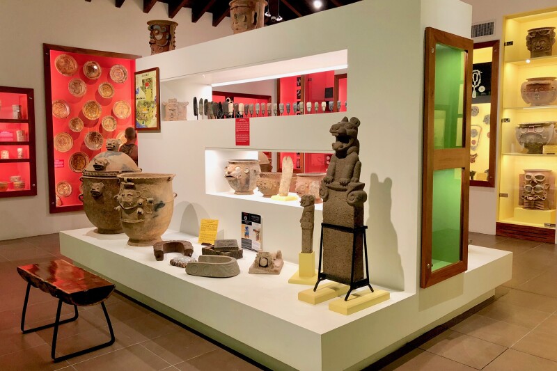
The museum at Las Lagunas Hotel exhibits the owner’s private collection of registered Mayan artifacts.
Photo by Melanie Haiken
And in addition to large-scale research projects, local efforts are broadening our understanding of Tikal as well, such as the museum opened in 2017 at the nearby boutique hotel Las Lagunas. The collection of artifacts amassed over 60 years by the hotel’s owner, Edgar Castillo, includes stone statues, intricately painted pottery, elaborate necklaces, carved buttons, and even skulls with jade-inlaid teeth. Each item is qualified and registered by the government of Guatemala (unlike many private collections), and together they help visitors understand a bit more about the rich and advanced artisanship of Mayan civilization. Hotel guests may visit the museum anytime for free, and it’s open to other visitors for a nominal five dollars.
An experience enhanced
All of this new knowledge hasn’t yet changed the park as it appears to visitors because most of the sites revealed by the LiDAR mapping remain inaccessible. But as Lopez guided us among the same temples and structures hundreds of thousands had toured before, our knowledge that these buildings were part of a vast metropolis made an already exciting experience that much more thrilling.
We stood still in astonishment at our first glimpse of the extraordinary complex of temples, palaces, and monuments that earned Tikal the status of national park in 1955 and UNESCO World Heritage site in 1979. It was the courtyard of the Central Acropolis, an imposing multi-story royal palace constructed of enormous limestone blocks stacked like Legos. Unlike in other Mayan ruins, such as Tulum and Chichén Itzá, almost all of Tikal’s structures are open and unrestricted, so we climbed the famous building’s steep stairways to explore the rows of rooms, admiring carved stone lintels, peeking through windows as we went, and wondering about the objects that may have decorated the interiors.
“These jungles are still full of mysteries, and we’re only just at the beginning of figuring it all out.”
Spread over a mammoth site and linked by winding forest paths, Tikal can take several days to explore thoroughly. But Lopez, the official tour guide of Las Lagunas, knows what he called “secret back ways,” which helped him fulfill his promise to show us everything of significance in one day.
From the Central Acropolis, Lopez lead us down a short path to Tikal’s grandest ediface, the looming, 180-foot Temple I (also called the Temple of the Jaguar or Temple of Ah Cacao, the ruler entombed there). Directly across the enormous Grand Plaza that fronts the temple is the equally imposing Temple 2. Also called the Temple of the Masks, it was built to honor Ah Cacao’s wife and is flanked by the North Acropolis and a series of carved stone stelae, or pedestals, covered with intricate symbols telling the histories of those who once lived here.
Lopez explained that twice a year at the equinox, the sun aligns in such a way that the shadow of Ah Cacao’s temple falls across that of his wife’s, a display of the Mayans’ mastery of archaeoastronomy that symbolically allows the couple to touch across time and death.

The structures of Tikal, such as the North Acropolis, are open to the public, allowing visitors to climb stairs and walk through rooms, imagining what life might have been like in 800 C.E.
Photo by Shutterstock.com
From there, another path took us to Temple IV, which is so tall that climbing it put us above the jungle canopy. Nearby, an observation platform lifted us even higher above the trees, and it was here that we were most strongly reminded of the LiDAR mapping’s findings. The temples and palaces we’d spent all day learning about suddenly seemed like such a small part of the city. In front of us, we could see the tops of as-yet-unexcavated pyramids piercing the sea of green that extended to the horizon in all directions, waiting to be explored.
Continuing to unravel the mystery
What we’ve learned from the LiDAR mapping so far just scratches the surface of Tikal, and many of its mysteries remain unsolved, including why it was suddenly abandoned around 900 C.E. Scholars still don’t agree on one explanation for the city’s fall, but the most likely contributing factors are unsustainable population growth, deforestation, drought, and crop failure—theories now supported by this new understanding of the area’s population density.
“We think people packed up and fled to the coast and into the highlands; the Mayans who live in the villages around Lake Atitlán may have come from this area,” Lopez told us at the top of Temple IV, sweeping a hand to the southeast, in the direction of that body of water more than 400 miles away.
Answers to these and other questions may come sooner than later—by the end of what is expected to be a three-year survey, PACUNAM’s LiDAR initiative plans to have mapped 5,000 square miles of the Guatemalan lowlands, which includes the 800 square miles of Tikal that have been covered thus far. The picture will only become more vivid for visitors 10 or 20 years from now. “These jungles are still full of mysteries, and we’re only just at the beginning of figuring it all out,” Lopez said. “It’s a very exciting time to be in Tikal.”
>>Next: Beautiful Abandoned Places Around the World That You Can Actually Visit


