

Good maps don’t just tell us where we are, they help to tell us who we are. They can also reveal all sorts of things about a place, which makes them perfect for travelers looking forward to—or reminiscing about—a trip.
We’ve selected eight books that span centuries and continents. They include all kinds of cartography, from hand-drawn designs to digital visualizations and artworks. Some are methodical, others whimsical. They’ll take you on a journey from the comfort of your favorite reading chair.

“All Over the Map” is a labor of love from National Geographic and former “Wired” staffers.
Courtesy of National Geographic. Background design by Emily Blevins.
All Over the Map: A Cartographic Odyssey
By Betsy Mason & Greg Miller
This delightful compendium from National Geographic and two former Wired staffers celebrates cartography from the days of “here be dragons” to the digital present over the course of 200-plus maps. If you can think of it, chances are it’s been presented here.
We’re talking maps designed to guide aliens to Earth, currently flying through space on the Voyager spacecraft. A detailed plan of Westeros, the fictional realm of Game of Thrones. A smellscape recording the odors of Kiev. A guide to San Francisco’s buried shipwrecks. It’s safe to say that All Over the Map is several degrees south of Rand McNally territory, and all the more weird and wonderful for it.
Buy it: $31, Amazon.com
“Unfathomable City” is part of a trilogy of books covering New Orleans, New York, and San Francisco.
Courtesy of University of California Press. Background design by Emily Blevins.
Unfathomable City: A New Orleans Atlas
By Rebecca Solnit and Rebecca Snedeker
This excellent book claims to offer a “provocation” rather than a comprehensive guide to the Crescent City, but over the course of 22 maps and accompanying essays it gives an unparalleled insight into a fascinating city.
With visuals covering everything from Katrina damage to the city’s bounce music scene, via parade routes, pipelines, the historic banana trade and much more, the authors add layers of context to a place they justifiably deem “all kinds of unfathomable.” The book is part of a trilogy that also plumbs similar depths in New York and San Francisco.
Buy it: $21, Amazon.com
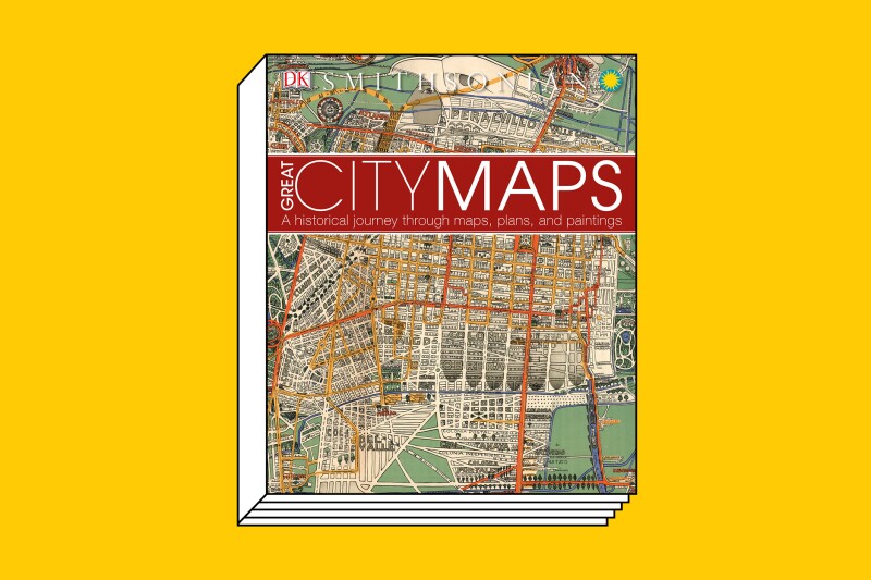
Publisher DK’s knack for visuals is again on display with “Great City Maps.”
Courtesy of DK. Background design by Emily Blevins.
Great City Maps: A Historical Journey Through Maps, Plans and Paintings
By DK
A doorstop of a tome, Great City Maps lays out in detail how cities around the world have evolved—and cartography along with them. Covering some 70 maps, broken down into genres including ancient cities, medieval trading places, imperial capitals, and colonial cities, it’s a beautiful bird’s-eye view of civilization’s coagulation in urban centers.
The depiction of New York’s development over the past few centuries is just one of many fascinating sequences. The city grows from a very green New Amsterdam in 1660—all Dutch forts and breweries set among orchards—to the subway-riddled metropolis we know today. In between, late 18th-century cartographer Bernard Ratzer’s engravings, an 1875 sketch of the boat-filled Hudson, and the skyscraper-dominated landscape of 1963 chart its change.
Prague, Lisbon, Rio de Janeiro, and London are among the many other cities whose streets are displayed in brilliant detail.
Buy it: $30, Amazon.com

This field atlas is not like other atlases.
Courtesy of Heyday. Background design by Emily Blevins.
The California Field Atlas
By Obi Kaufmann
If you’re looking for freeways or pathways, expressways or BART lines, this book can’t help you. If, on the other hand, you’re looking to get lost in the flora, fauna, and natural habitats that exist across California beyond the I-5, this is a wonderful little guide.
Broken down into sections like “Of Wind and Weather” and “Of Parks and Protection,” and illustrated with watercolors of pinecones, wolves, and birds, it’s a passionate celebration of everything in the state that’s been untouched by humans. Each of the small maps consciously avoids any state lines, roads, or buildings, instead featuring river routes, mountain ranges, and elevation to highlight the importance—and fragility—of existing ecosystems.
Buy it: $31, Amazon.com

“You Are Here NYC” covers the Big Apple from every angle.
Courtesy of Princeton Architectural Press. Background design by Emily Blevins.
You Are Here NYC: Mapping the Soul of the City
By Katharine Harmon
New York City’s soul is a complex, amorphous thing, but this ambitious collection of illustrations, infographics, artworks, and illustrations makes numerous valiant attempts to pin it down.
Every page shines a different light on the city, whether through hand-drawn New Yorker covers, interactive data visualizations, or photographs of artifacts like designer Meredith McNeal’s transit map dress.
Featuring representations of the city from 1600 onward, it’s full of big names (Andy Warhol, John Cage) as well as lesser-known cartographers, and source material runs the gamut from dusty archives to International Space Station photographs.
Some artworks leave room for interpretation while others focus the spotlight more clearly—like Liz Scranton’s The Drive of the Hive, a honeycomb map of the subway landforms that changed over time as the bees did their thing. As the caption has it: “Within close confines, literally living on top of each other, hive residents were a model of cooperation, each part of a remarkable metropolis filled with sweet lucre.”
Buy it: $19, Amazon.com
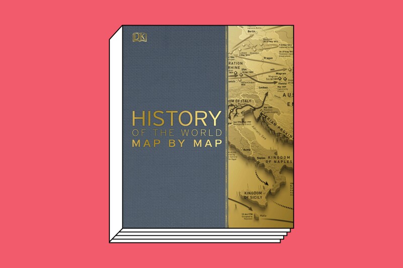
Humankind’s progress has been carefully mapped out in this giant tome.
Courtesy of DK. Background design by Emily Blevins.
Smithsonian: History of the World Map by Map
By DK
From “The First Humans” to “Population and Energy,” the 140 maps in this weighty book tell the tale of humanity through key events and with DK’s signature vibrant mapping and illustrations. As British broadcaster Peter Snow states in the introduction, “A country’s history is shaped by its geography . . . just as much as it is shaped by its population, its industry, its relations with its neighbors and its takeover by invaders from abroad.” The book sets every region on the globe in historical context.
Travelers to, say, Istanbul or Eastern Europe will be able to visualize the waxing and waning of the Ottoman influence over that region. Those heading to England or Scotland will find that the maps “Industrial Britain” and “British Civil Wars” explain some of the history they’ll encounter along the way. In short, a perfect armchair flight over lands and times that will prime you for any trip.
Buy it: $36, Amazon.com

“The Phantom Atlas” demonstrates how often mapmakers got things wrong.
Courtesy of Chronicle Books. Background design by Emily Blevins.
The Phantom Atlas: The Greatest Myths, Lies and Blunders on Maps
By Edward Brooke-Hitching
It’s hard to imagine on present day (Google) Earth, but for centuries paper maps were all we had—and they were often wildly, dangerously, or laughably inaccurate. This beautiful book chronicles all manner of misguided designs, sketching out a planet full of nonexistent islands, giant lobsters and sea rhinoceroses, where California is separated from the U.S. mainland, and the Earth—in a map as late as 1893—is completely flat.
The book won’t help you get from A to B, but it will take you on a glorious journey.
Buy it: $30, Amazon.com

“The MInard System” collects 60 of Charles-Joseph Minard’s seminal designs.
Courtesy of Princeton Architectual Press. Background design by Emily Blevins.
The Minard System: The Complete Statistical Graphics of Charles-Joseph Minard
By Sandra Rendgren
Charles-Joseph Minard may be best known for his representation of Napoleon’s 1812 march into Russia, but he painstakingly chronicled much of the 19th century’s economic and cultural moments in a series of maps that set a template for modern data visualization.
This Princeton Architectural Press collection presents 60 of his statistical graphics, covering everything from the burgeoning global cotton trade to canal and railway traffic in Europe.
Even apparently unfinished works, like “Maritime Ports in France in 1850,” where traditional boundaries are eschewed for a system of circles whose size marks the importance of each place, offer a fascinating insight into his process.
Buy it: $60, Amazon.com
This piece was originally published on Oct. 18, 2018 and was updated on Dec. 7, 2020 with current prices. AFAR participates in affiliate marketing programs, which means we may earn a commission if you purchase an item featured in this story. All products and services listed here are independently selected by AFAR journalists.
>> Next: 8 New Books You Need to Read Before Flying to France


