In the world of long-distance hiking, few treks match the allure of the Appalachian Trail (AT), Pacific Crest Trail (PCT), and Continental Divide Trail (CDT). They span thousands of miles across some of North America’s most beautiful deserts, mountains, and forests.
Each trail presents distinct challenges and rewards to those who dare to tackle it. Thru-hikers must contend with unpredictable weather, complicated logistics, and the physical demands of walking thousands of miles—often camping in the wilderness for weeks or months at a time. Accomplishing one is enough of a challenge, but for the rare few who manage to complete all three (only about 700 people have been recognized by the American Long Distance Hiking Association – West), they receive the distinction of having achieved the Triple Crown of Hiking.
Liz Thomas is a Triple Crowner (who even once broke the record for fastest female thru-hike of the AT) and is the current editor-in-chief of hiking website Treeline Review. Thomas offers AFAR readers some insights into what each trail is like, as well as some of their can’t-miss segments.

More than three million people visit the Appalachian Trail every year.
Photo by Jonathan A. Mauer/Shutterstock
Appalachian Trail
Best for: dipping your toes into long-distance hiking
The Appalachian Trail is a footpath that stretches approximately 2,200 miles along the Appalachian Mountain Range in the eastern United States. Beginning at Springer Mountain in Georgia and ending at Mount Katahdin in Maine, it traverses through 14 states and 75 different federal and state forests and park lands, largely passing through wooded areas along the mountains’ spines, ranging from oak-hickory forests to northern hardwoods.
Thomas recommends it to first-timers because it’s the shortest of the triple-crown trails and frequently goes through towns (like Damascus, Virginia, and Duncannon, Pennsylvania), where hikers can stock up on food and replace broken gear.
“The AT is a bit more about community and meeting people along the way,” Thomas added. “It’s a little more crowded, but that means you’ll have people who can help you.”
Hikers who aim to complete the entire trail in one continuous journey typically take five to seven months, though the AT is known for section hiking (meaning trekkers tackle chunks of the trail over a series of years). Going that route, Thomas says, also helps reduce congestion on the trail.
Can’t-miss spots on the Appalachian Trail
According to Thomas, one standout section is the stretch through the Great Smoky Mountains National Park, where hikers are treated to panoramic views of mist-covered valleys and hemlock forests. Another one of her favorites: the White Mountains of New Hampshire, where intrepid trekkers encounter challenging, steep terrain that requires good scrambling skills.
“A lot of the AT is in what is called a ‘green tunnel,’ so you’re in the trees,” Thomas says. “But when you get to the White Mountains, you get more expansive views. [Conservation organization] Appalachian Mountain Club runs a hut system through there as well, so a lot of backpackers stay overnight there and can sleep in a bed and have dinner, which feels like a novelty on such a long hike.”

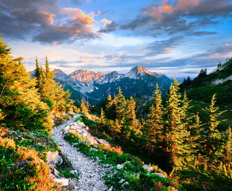
The Pacific Crest Trail is especially known for its awe-inspiring vistas.
Photo by Tobin Akehurst/Shutterstock
Pacific Crest Trail
Best for: jaw-dropping scenery
Stretching approximately 2,650 miles along the western edge of the United States, the Pacific Crest Trail begins in Campo, a small town on the U.S./Mexico border, and winds its way northward through California, Oregon, and Washington before terminating in the Pasayten Wilderness near the U.S./Canada border.
Along the way, hikers traverse through arid expanses of the Mojave Desert and the towering peaks of the Sierra Nevada and Cascade ranges, passing through 7 national parks, 26 national forests, 5 state parks, and 4 national monuments.
“The PCT has big vistas,” Thomas says. “The views along the entire trail are really, really stellar.”
The hikers who decide to undertake the entire PCT in a single season typically start in the spring and finish in the fall. However, to do so, hikers need to get advance permits to do the entire route. Only 50 are allotted each day, so aspiring PCT hikers need to plan ahead.
Can’t-miss spots on the Pacific Crest Trail
The PCT also offers countless opportunities for shorter day hikes and backpacking trips for people of all skill levels. Thomas says popular parts include the desert sections of Southern California, with Seussically-shaped rock formations and towering cacti, and the snow-capped volcanoes and dense evergreen forests of Northern California’s Cascade Range.
The Sierra Nevada portion in particular, according to Thomas, is the “real jewel of the trail.” On this more than 500-mile-long portion—where the highest point reaches 13,153 feet—hikers scale granite peaks to reach alpine lakes and meadows blanketed in wildflowers.
“It’s a difficult segment, you’re at high elevation, but it also kind of builds a community of other hikers around you as you’re going through it together,” she says.

The Continental Divide Trail can be a great way for experienced hikers to test their abilities.
Photo by Travis J. Camp/Shutterstock
Continental Divide Trail
Best for: hikers who want to test their abilities
The Continental Divide Trail is the longest of the Triple Crown hiking trails in the United States, snaking roughly 3,100 miles through rugged and remote terrain in the Rocky Mountains. Cutting through New Mexico, Colorado, Wyoming, Idaho, and Montana, the hike offers panoramic mountain-top views of snow-capped peaks and clear mountain lakes.
Unlike the PCT and AT, the CDT is not fully developed or maintained, meaning hikers must navigate a combination of established trails, dirt roads, and off-trail routes, often relying on maps, compasses, and GPS devices to find their way. This adds an extra layer of challenge and adventure to the journey, requiring self-sufficiency and wilderness skills. Completing the entire trail in one go takes an average of about five and a half months.
“Most people will choose to tackle the CDT after they have a little bit more trail experience, just because you’re so out there,” Thomas says. “It’s such a remote trail, so having time on the others, where you can learn from mistakes, is important. The CDT is not a very forgiving trail for learning as you go, and if something happens, it’s going to be a lot harder to get rescued. There are bigger consequences.”
Can’t-miss spots on the Continental Divide Trail
One popular section is New Mexico’s Gila Wilderness, a more than 500,000-acre area where ancient cliff dwellings and hot springs are found among the desert mesas, according to Thomas. Another highlight is Montana’s Bob Marshall Wilderness, which has river valleys and meadows with herds of elk and mountain goats.
And when the CDT gets tough, don’t quit—Thomas says one of the best parts of the trail is its finale in Montana’s Glacier National Park: “The trail ends at Waterton Lakes, which are half in Canada and half in the U.S. You can stand on this dock and look out at this epic mountain-lined lake, and it’s really something special.”


