

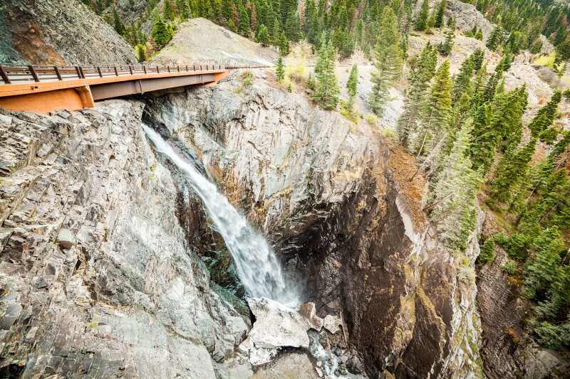
Why settle for a mere byway when you can cruise across a skyway? A 232-mile loop through the San Juan Mountains, known as the San Juan Skyway, will have you asking yourself this very question. The rugged range in southwestern Colorado is home to some of the country’s most dramatic panoramas. Craggy peaks soar high above idyllic, pond-pocked meadows. Hugging the near-vertical landscape are alpine forests of aspen and evergreen. And you can access it all by sealed road (Highway 145, Highway 62, Interstate 160, and Interstate 550).
On this journey, you’ll encounter more than a dozen 14,000-foot summits—a quarter of the state’s total—as well as Victorian-era mining towns, waterfalls, and wildlife of all shapes and sizes. You can easily tackle the loop in two days, but allow at least four if you want to fully explore the backcountry along the way. Plan your trip during the summer months to enjoy snow-free transit, and maybe even a live concert or two. Telluride, at the journey’s halfway point, is the state’s festival capital.

Illustration by Emily Blevins, animation by Claudia Cardia
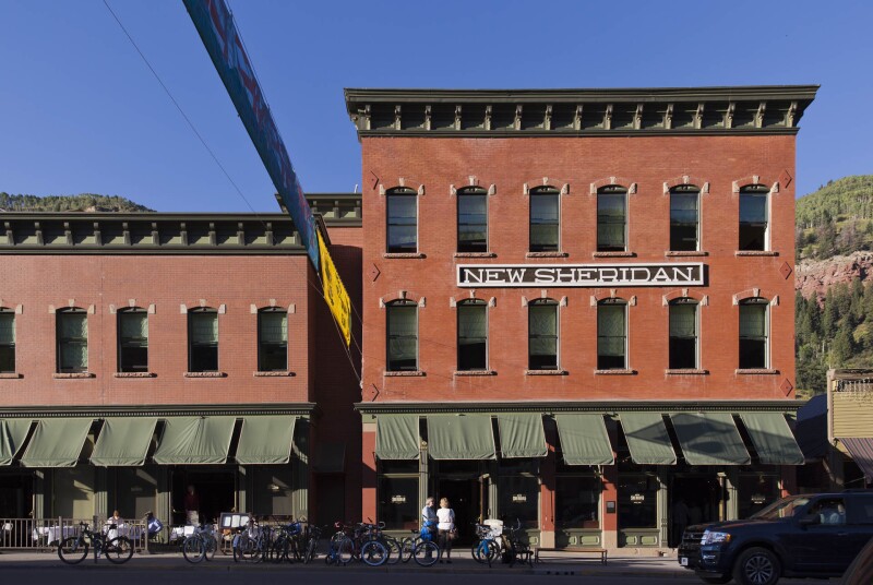
The Hotel New Sheridan features a rooftop bar with views of downtown Telluride.
Photo by Rebecca Stumpf
If neither camping nor “glamping” is your thing, however, you can still enjoy a leisurely circuit across the mountain range without driving more than 100 miles in a single day.
Day one: 10,000-foot passes and your choice of breweries Begin your journey in Durango, the biggest “city” on the Skyway, with a population of just over 18,000 year-round residents. If you have time to spare, take a stroll along the Animas River, which winds its way through downtown. One of the last free-flowing rivers in the state, it is loaded with rainbow trout, a popular attraction for fly-fishers.
Stop for barbecue at Ska Brewing Co., a wind-powered microbrewery just south of downtown. From a charming beer garden, it serves potent IPAs and its signature Mexican Lager.

Mount Sneffels soars at 14,157 feet.
Courtesy of Marilyn D. Lambertz/Shutterstock
Head north out of town to begin the 48-mile drive up to Silverton. As you make the slow climb over two successive 10,000-foot passes, you’ll catch your first glimpse of those 14,000-foot peaks (“14ers”)along the route—Eolus, Windom, and Sunlight tower over the passenger side view. But be sure to keep your eyes on the road; bighorn sheep, elk, mule deer, and black bears roam these dense forests in great number. Use even greater caution negotiating the road’s switchbacks as you descend into the preserved mining town of Silverton. It rests at the seat of a mountain valley as steep as it is stunning. Most of the buildings along Greene Street—anchored by the red-brick Grand Imperial Hotel—date back to the late 19th century, when prospectors settled in with lofty dreams of gold and silver.
Recharge at Avalanche Brewing Company, a cozy brewpub and coffee shop on Blair Street. A colorful front patio provides an unrivaled setting for enjoying pizza and porter.
Continue on toward Red Mountain Pass, the Skyway’s highest point. A pullout here overlooks its namesake formation: a rust-hued mound, the remnants of an ancient volcanic cone.
Ouray is known as the “Switzerland of America” for its deep canyons and many waterfalls.
Courtesy of Sopotnick/Shutterstock
Next you’ll drop down into the 550-acre municipality of Ouray. Boxed in by steep, waterfall-lined canyon walls, it’s been called the “Switzerland of America.” If you’re in need of a recharge, check out the town’s hot springs—a series of natural thermal baths that have been converted into a local pool, of sorts. From here, the mountains begin to fade in favor of alpine meadows and cowboy country. Snowcapped peaks give way to sprawling pasture, strewn with cattle and wildflowers. In the ranching town of Ridgeway, you’ll veer west on Highway 62. Crumpled earth reemerges in dramatic fashion as you cross the Dallas Divide. Directly outside the driver’s-side window, Mount Sneffels reveals its triangular apex, unobstructed, at 14,157 feet in elevation.
Follow the road 15 miles west to Placerville, a former mining camp along the banks of the San Miguel River. Here you’ll pick up Highway 145 south and ride it 15 more miles into Telluride. This storied resort town is well worth the stop. It sits at the base of a box canyon, with horizontal layers of red sedimentary rock closing in from three sides. A playground for outdoor adventurers and Hollywood celebrities alike, the town kicks off its summer season with the annual Telluride Bluegrass Festival, continues with the Telluride Film Festival, and ends with a Horror Show festival in October.

Ska Brewing Co. is a wind-powered microbrewery with barbecue near downtown Durango.
Courtesy of Ska Brewing Co.
Your best bets for overnight lodging are also found here. Book your stay at The Hotel Telluride, with its charming, wood-cabin aesthetic in the lobby and modern rooms. Or rest your head at the New Sheridan Hotel, a Victorian-era lodging featuring a rooftop bar overlooking town and the ski resort. Enjoy dinner at The Tunnel, a speakeasy restaurant billing itself as a throwback to the Prohibition Era during the town’s mining days. A preset menu is served at shared tables, with only two seatings per night. To gain entry, you’ll need to find the password printed in the most recent issue of the Telluride Daily Planet.
Day two: Sprawling vistas and Mesa Verde
Get an early start on your second day, as you still have 123 miles of road left to complete the loop. The first leg takes you down the remainder of Highway 145. Ascend Lizard Head Pass and stop to take photos of the oddly spired, towering rock formation that inspired its name. In the distance are two more 14ers—Mount Wilson and Wilson Peak. The latter, depicted on cans of Coors Light, became world-famous.

Telluride is home to several arts festivals, including a bluegrass festival, horror film festival, and the Telluride Film Festival.
Courtesy of Ryan Bonneau/Visit Telluride
Over the next two hours, you will skirt the Dolores River Valley as the topography slowly opens. Eventually, just north of Cortez, the tight-grip mountain vista releases you into a sprawling, mesa-rimmed panorama. From here, you’ll slowly start to descend back into civilization. If you’re a fearless gourmand, stop in at the Main Street Brewery in the heart of Cortez for an order of Rocky Mountain Oysters. They’re deep fried, which certainly has a way of making bull testicles more appealing.
After lunch, you’ll turn east on Interstate 160 for your final 52-mile stretch of Skyway. Allow at least two hours to fully explore Mesa Verde, your last stop before returning to Durango. The 81-square-mile archaeological preserve is the nation’s largest, containing some 600 cliff dwellings that once belonged to the Ancestral Puebloans. Following an afternoon of immersive cultural exploration, you’re just 35 miles away from completing your loop back in Durango.

At 81 square miles, Mesa Verde is the largest archaeological preserve in the U.S.
Courtesy of Jeffrey M. Frank/Shutterstock
What to bring A guide. To help navigate the scenery, purchase a copy of One Drive in a Million. It’s a mile-by-mile guide to the Skyway, available on Amazon for $15. If you’re in the mood for something more contemplative, consider Desert Solitaire, naturalist Edward Abbey’s ode to the majestic, untamed beauty he discovered in this part of the world.
A camera. Most of this sweeping scenery cannot be properly captured with your smartphone alone. If you own one, make sure to pack a proper digital-SLR camera—preferably with a wide-angle lens.
Additional tips
Ride a gondola for epic views. Telluride Station Gondola provides free transit between downtown and Mountain Village by way of this sustainably powered lift. It affords jaw-dropping views of the canyons and valleys below while climbing to nearly 12,000 feet in elevation.
Keep in mind that weather in the San Juans fluctuates rapidly. A clear blue sky may belie the impending menace of a thunderstorm just over the distant horizon. If you plan to explore the region by foot, a lightweight rain jacket and sturdy hiking shoes are essential. Also consider bringing a tent and backpack; the surrounding San Juan National Forest contains nearly 2 million acres of pristine wilderness. Much of the land is open to dispersed camping—no amenities or facilities—so you must pack out whatever you pack in.

The Telluride Station Gondola reaches nearly 12,000 feet, offering aerial views of the canyons and valleys.
Courtesy of Ryan Bonneau/Visit Telluride
Go off-road. If you want to get much deeper into the backcountry—and you have access to a reliable 4x4—the Skyway isn’t short on rugged off-road diversions. The Alpine Loop National Back Country Byway is one option. Open only from June to September, it’s a 65-mile four-wheel-drive trail traversing treeless tundra and rocky ridges. You can pick it up in Silverton or just south of Ouray on U.S. 550. Conquer Imogene Pass. And if you’re absolutely certain you don’t have a fear of heights, try climbing out of Telluride’s steep box canyon by way of Imogene Pass. Seven miles of dirt switchbacks leads to its 13,114-foot zenith—the highest mountain pass in all the San Juans. Along the four-hour drive, you’ll pass the ghost town of Tomboy. Drive carefully.


